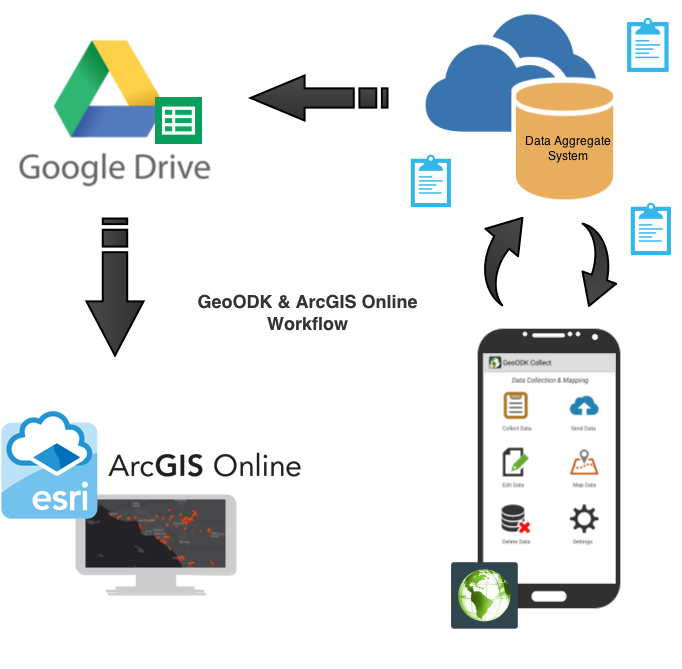
Learn how to intergrate GeoODK Collect with Google Drive & ArcGIS Online.
View Blog
A Data collection and Mapping application for your project and data collection needs.
Try it Out!
Take maps with you in the field while collection data, all in one app
Learn how
GeoODK provides a way to collect and store geo-referenced information, along with a suite of tools to visualize, analyze and manipulate ground data for specific needs. It enables an understanding of the data for decision-making, research, business, disaster management, agriculture and more. As a multi-dimensional application, GeoODK’s goal is to provide an open source platform that can be expanded to address current and future needs of data collection.

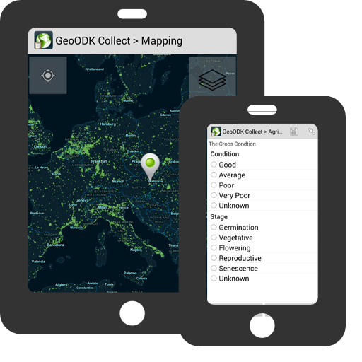
The mobile App (Collect) was derived from the Open Data Kit developed by University of Washington. We then added both an online and offline mapping component and some addition spatial widgets, as well as a developer option for deploying surveys with the app. (See more information)

A custom build of Formhub has also been created, I suggest for server side aggregation of data to use Formhub. This web application is a heavily supported by its community and a useful tool to branch. For sensitive data and I suggested creating your own build on your own server. (See instruction)
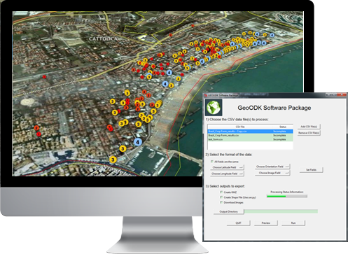
The Mobile Data Conversion Kit is a desktop application to downloads the images create ESRI shape files and google earth KML files of the data collected via Mobile device. (See more information)

 Git Hub »